Maps
Exhibit A-01 - City IOF Specific Plan Parcel Components Key Map(PDF, 1MB)
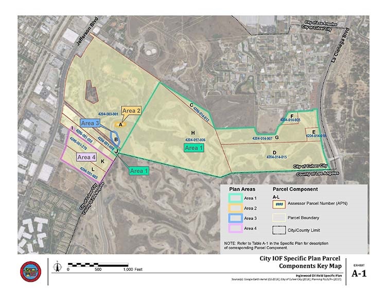
Figure 01 - Regional Location Map(PDF, 2MB)
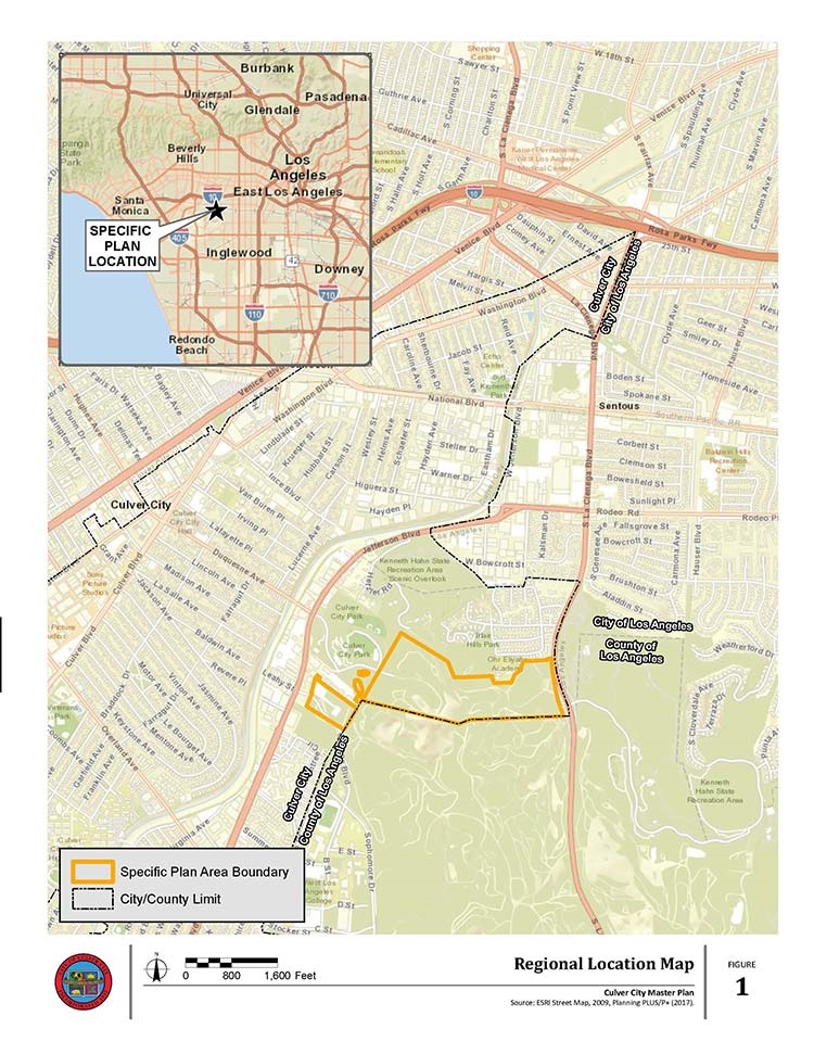
Figure 02 - Specific Plan Location Map(PDF, 2MB)
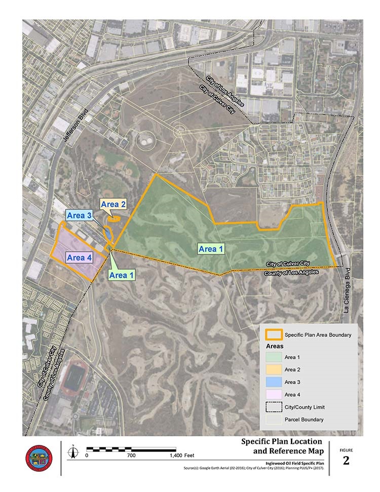
Figure 03 - Inglewood Oil Field Context Map(PDF, 1MB)
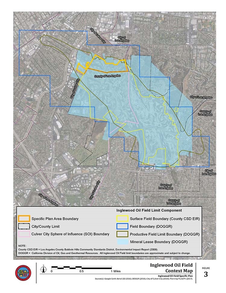
Figure 04 - Existing City IOF Conditions(PDF, 2MB)
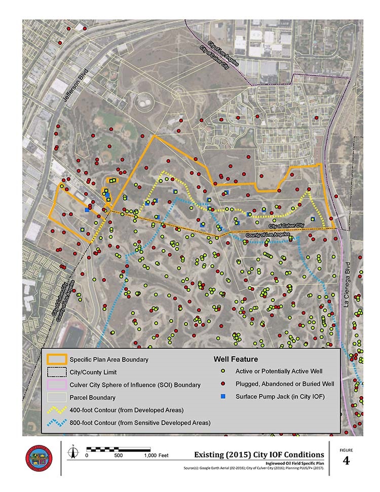
Figure 05 - General Plan Land Use Designations(PDF, 2MB)
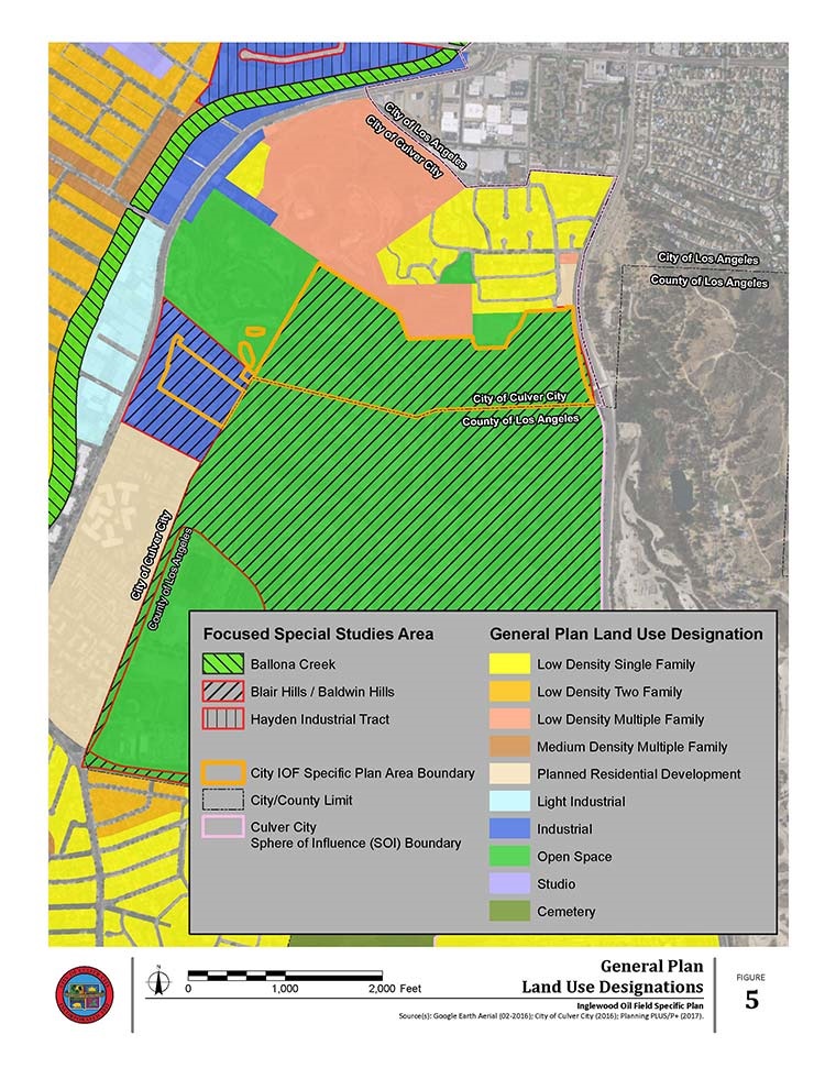
Figure 06 - Zone Districts(PDF, 1MB)
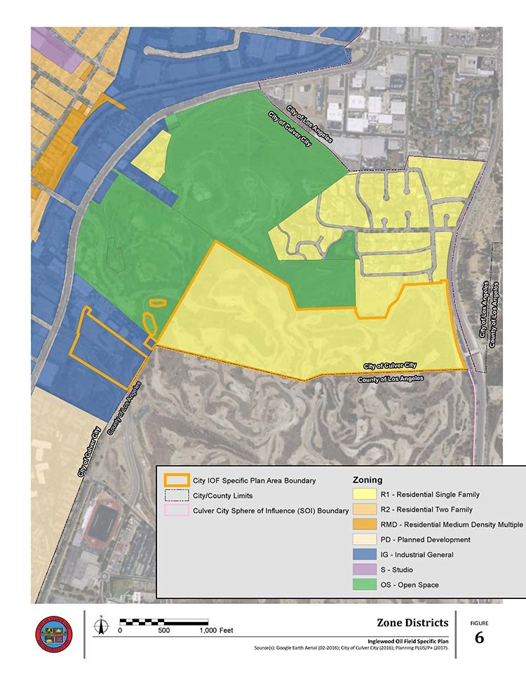
Figure 07 - Surrounding Developed Areas and Sensitive Uses(PDF, 1MB)
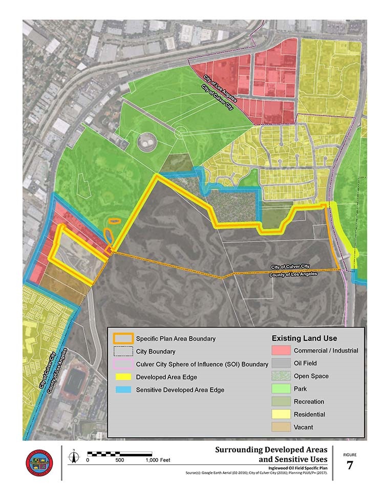
Figure 08 - Designated Drilling Areas and Setbacks Plan(PDF, 1MB)
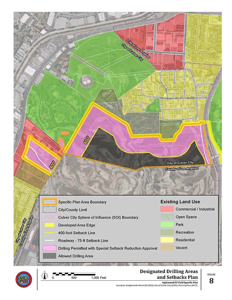
Figure 09 - Designated Deep- and Mid-Zone Drilling and Supplement Areas Plan(PDF, 1MB)
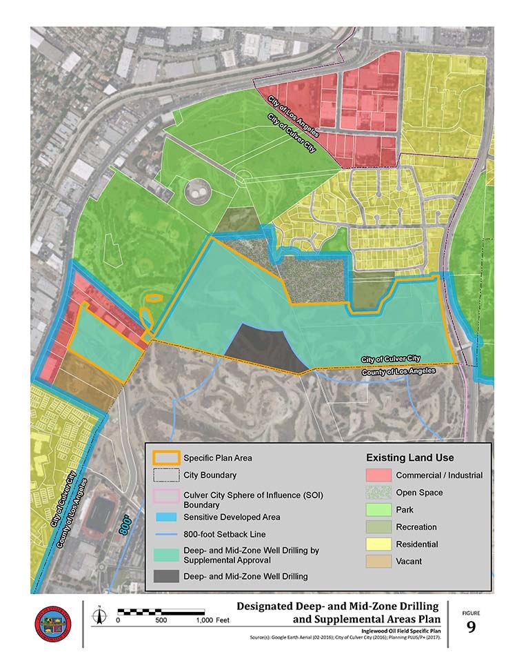
Figure 10 - Existing Parks, Recreation, Trails and Open Space Uses(PDF, 2MB)
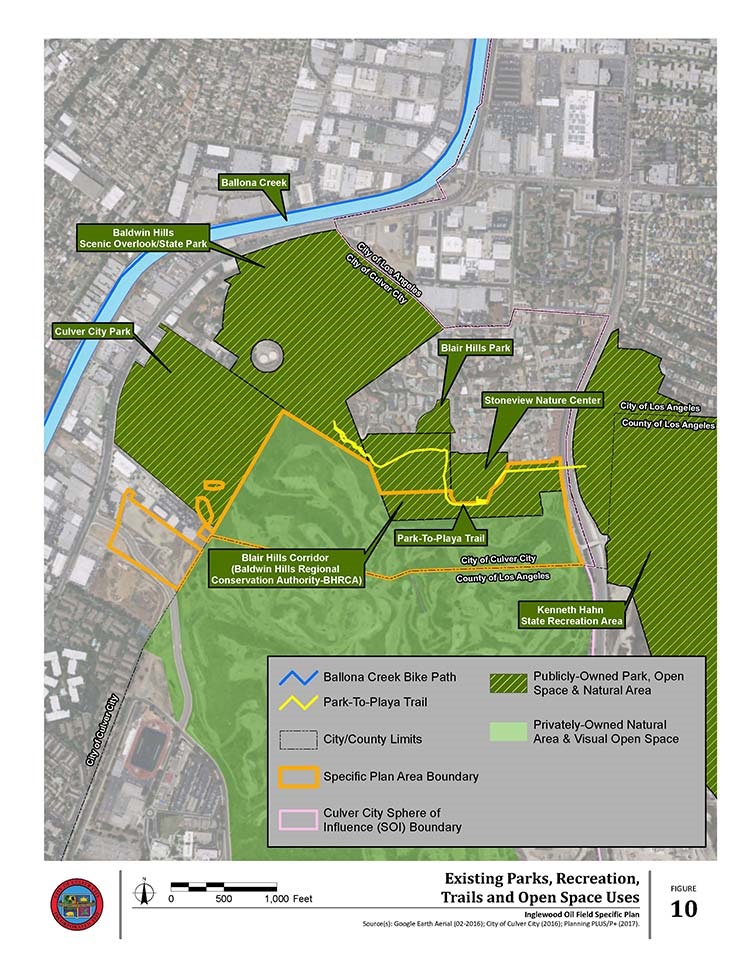
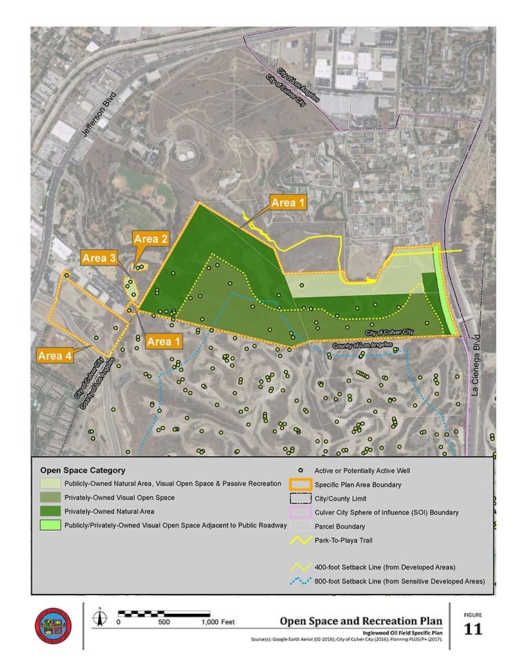
Figure 11 - Open Space and Recreation Plan(PDF, 2MB)